|

|
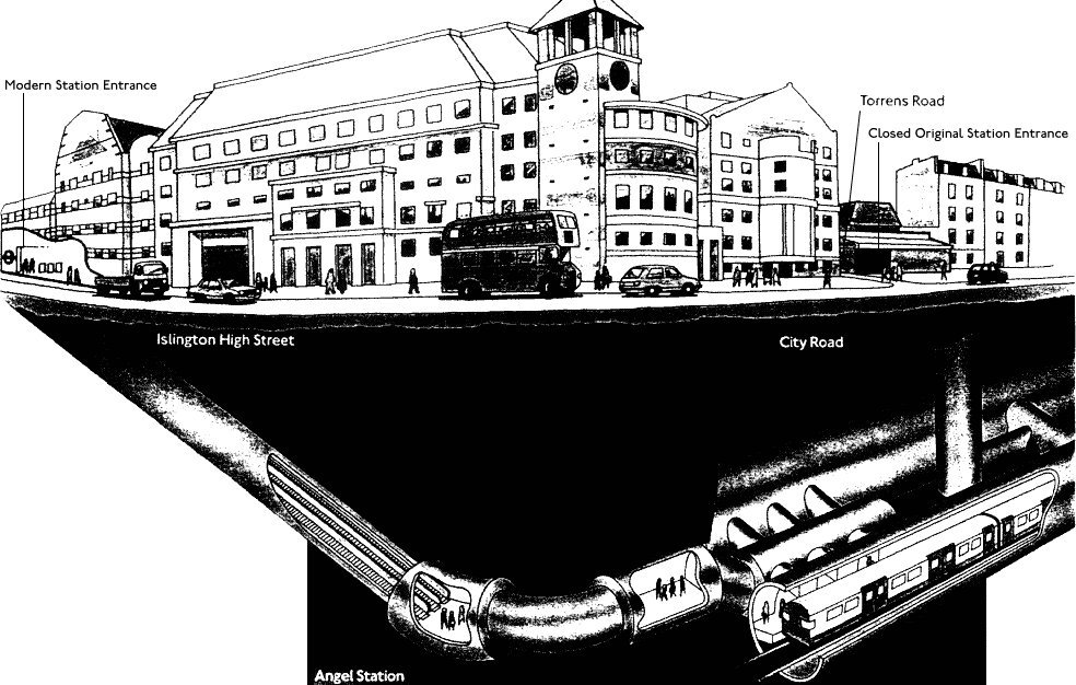
Angel, as rebuilt in the early nineties (63k) |
|
|
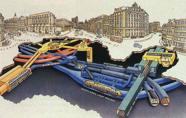
Bank / Monument monochrome (28k) and colour (67k) |
|
|
Bond Street: 1970s reconstruction for the Jubilee Line, which was known as the Fleet Line
during the planning phase (140k) |
|
|
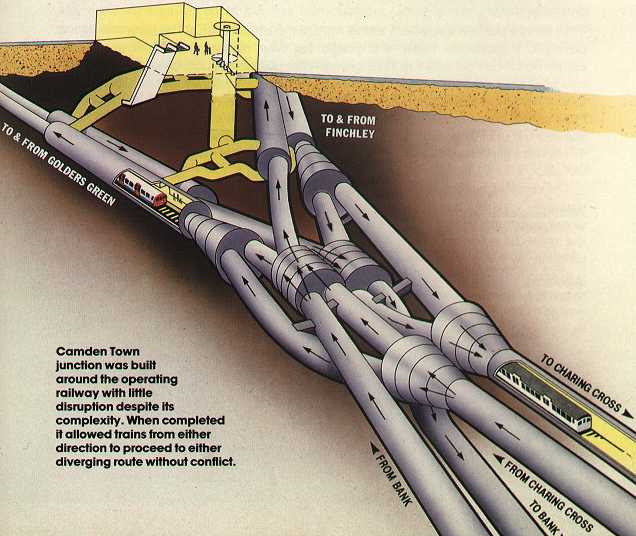
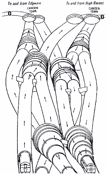
Camden Town station and junction (45k) or junction (13k) |
|
|
Canada Water: this station is still under construction, but there is a 3D
diagram (71k) on the JLE website |
|
|
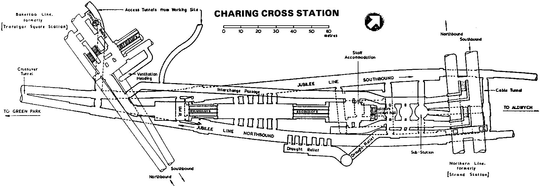
Charing Cross (26k) |
|
|
Embankment (54k) |
|
|
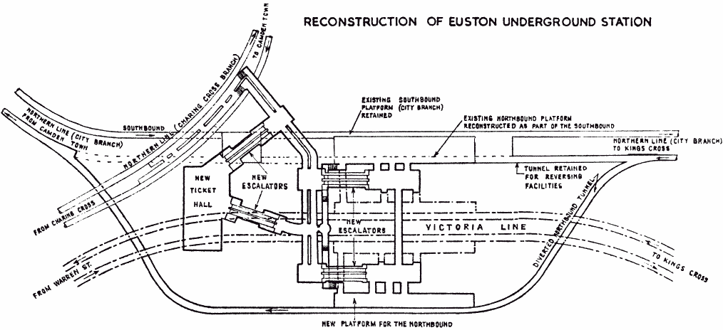
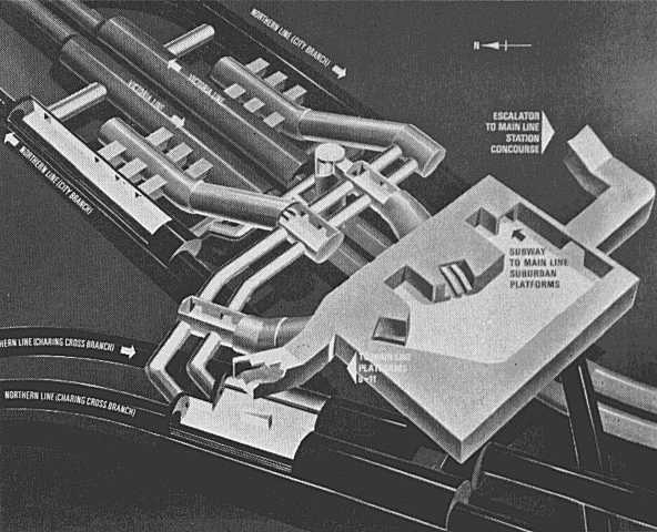
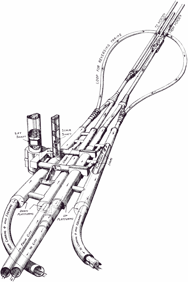
Euston plan of 1960s reconstruction for the Victoria Line (30k) or 3D
(39k) |
|
|
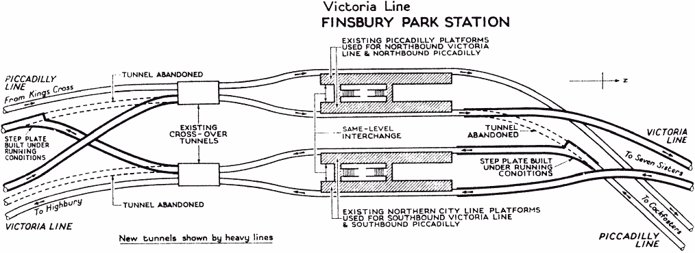
Finsbury Park tube platforms and tunnels after 1960s reconstruction for the Victoria Line(29k) |
|
|
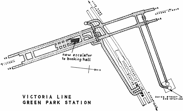
Green Park: 1960s plan of Victoria Line construction predates the Jubilee Line construction
(24k) |
|
|
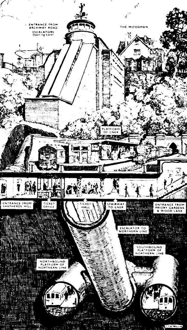
Highgate, including surface platforms now closed (67k) |
|
|
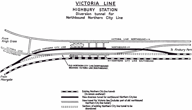
Highbury & Islington tube platforms and tunnels after 1960s reconstruction for the Victoria
Line(12k) |
|
|
Kennington (54k) |
|
|
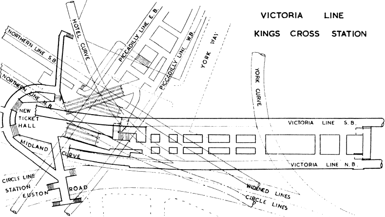
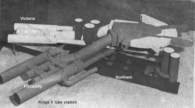
Kings Cross isometric (72k), plan (76k) and model
of deep level tubes (102k, scanned by Hans Van Oost) |
|
|
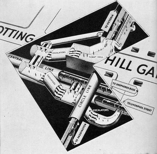
Notting Hill, with south at the top (49k) |
|
|
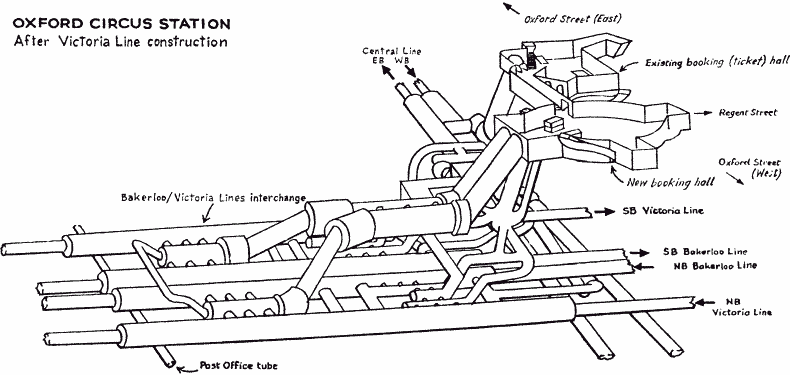
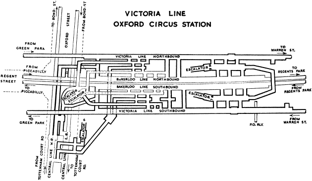
Oxford Circus 3D (20k), plan (25k) and model
(78k) |
|
|
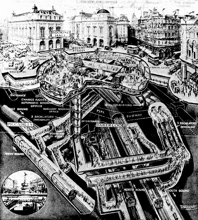
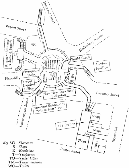
Piccadilly Circus woodcut (209k) and booking hall plan (26k) |
|
|
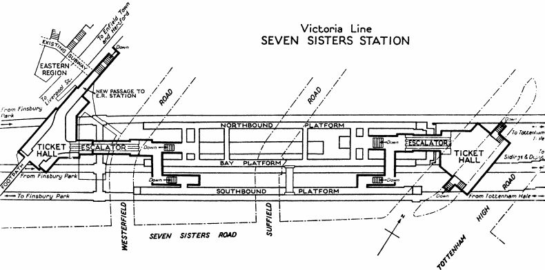
Seven Sisters (32k) |
|
|
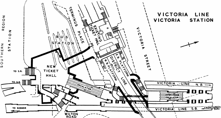
Victoria (36k) |
|
|
Cross section through Chalk Farm, Belsize Park, Hampstead and Golders Green (31k) |
|
|
Jubilee Line stations from Green Park to Stratford can be found in a book called "Extending the Jubilee Line".
(I never scan images from books which are still making money for the authors.) |
|
|
Guestbook |
 since 8th August 1999